

Today we are going to talk about the very interesting Torres del Paine Mountains formation, its geology and its historic importance.
We are today in Puerto Natales, studying a little bit more about the Torres del Paine Geology and I would like to invite you to join us in this fantastic world. And if you haven’t visited my post about Torres del Paine, now is the time! Check it out clicking here!
Torres del Paine History
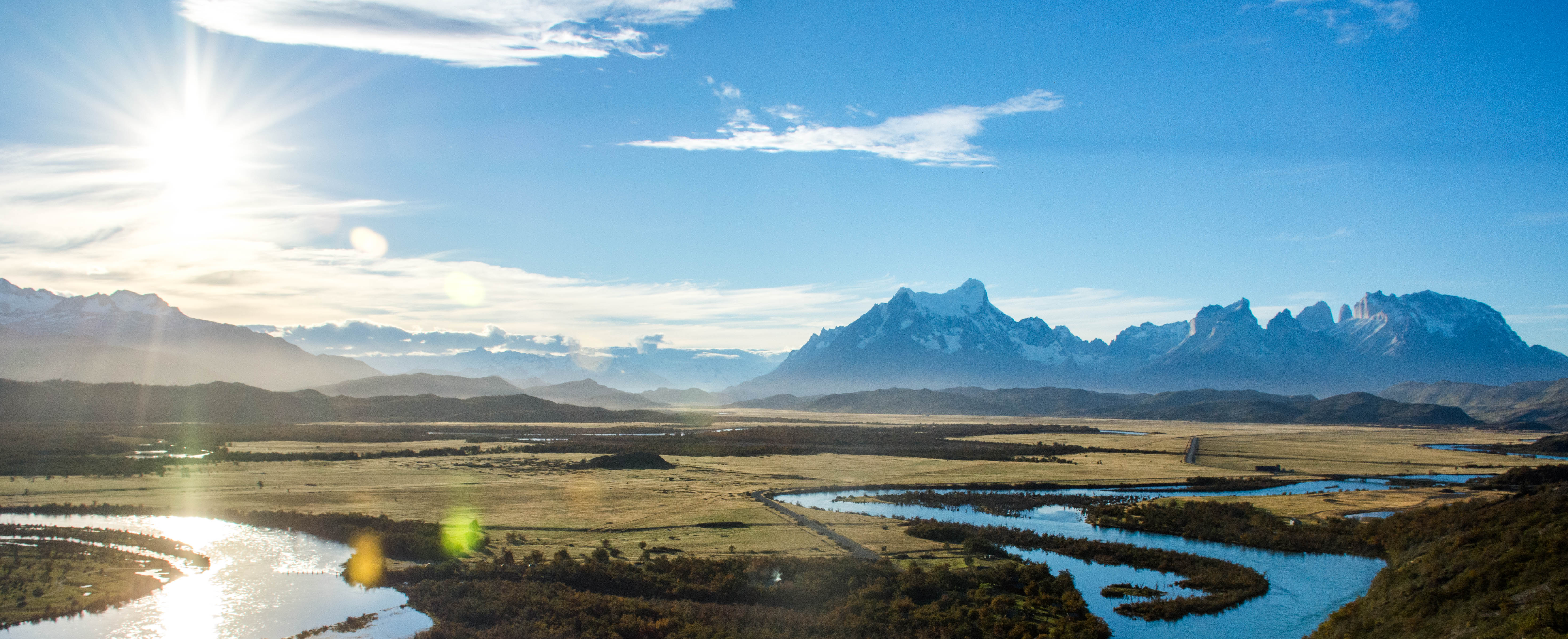
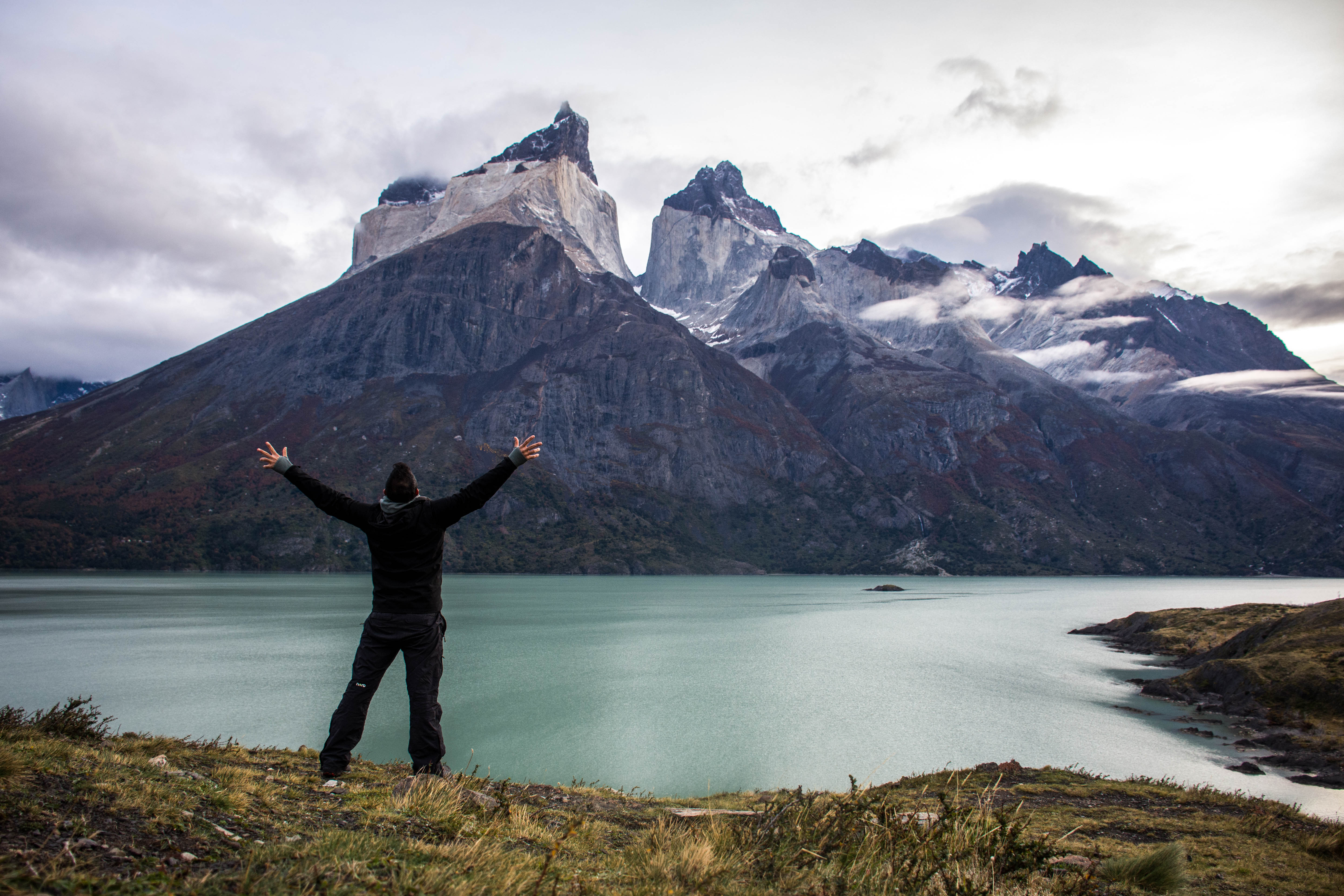
I’m pretty sure you’ve already heard about this famous place in Patagonia. The Paine mountain range is one of the main attractions of the Torres del Paine National Park, a world-class tourist site located 150 km north of the city of Puerto Natales, in the southern Patagonian zone of Chile. It is made up of several prominent hills, such as the Torres del Paine itself, and correspond to the most representative rock formation in the region, composed by a great mix of sedimentary, igneous and metamorphic rocks. It is known as a great hiking destination and a famous rock climbing international circuit. With its amazing landscapes and unique wildlife, was officially created in 1975 by CONAF and it was declared as a Biosphere Reserve Site by Unesco (1978).
Lady Florence Dixie, in her book published in 1880, gave one of the first descriptions of the area and referred to the three towers as Cleopatra’s Needles. She and her party are sometimes credited as being the first «foreign tourists» to visit the area.
Several europeans scientists and explorers visited the area in the following decades, providing important information about this very singular topography, harsh weather condition, beautiful mountains and local native people. Among these characters, we can recognize Otto Nordenskiöld, Carl Skottsberg, Alberto María de Agostini and Gunther Plüschow, a german pilot, who was the first person to fly over the Paine massif.
In 1976, British mountaineer John Garner and two Torres del Paine rangers, Pepe Alarcon and Oscar Guineo pioneered the Circuit trail which circles the Paine massif. In 1977, Guido Monzino donated 12,000 hectares (30,000 acres) to the Chilean Government when its definitive limits were established. The landscape of the park is finally dominated by the Paine massif, which is an eastern spur of the Andes located on the east side of the Grey Glacier, rising dramatically above the Patagonian steppe. Small valleys separate the granite spires and mountains of the massif. These are: Valle del Francés (French Valley), Valle Bader, Valle Ascencio, and Valle del Silencio (Silence Valley).


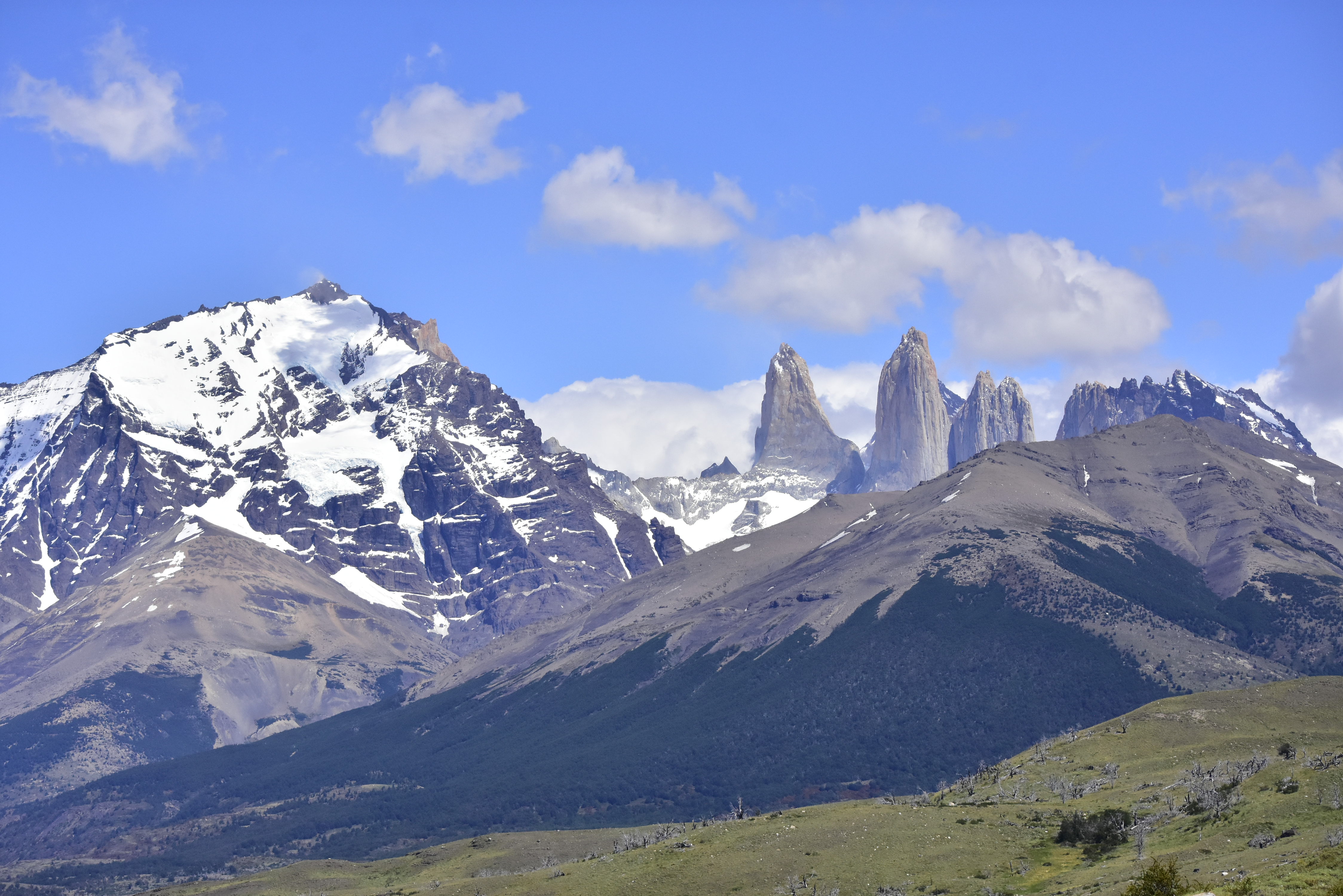

Main mountains that can be seen at the Torres del Paine National Park:
Cerro Paine Grande: 3,050m.
Cerro Paine Chico: 2,650m.
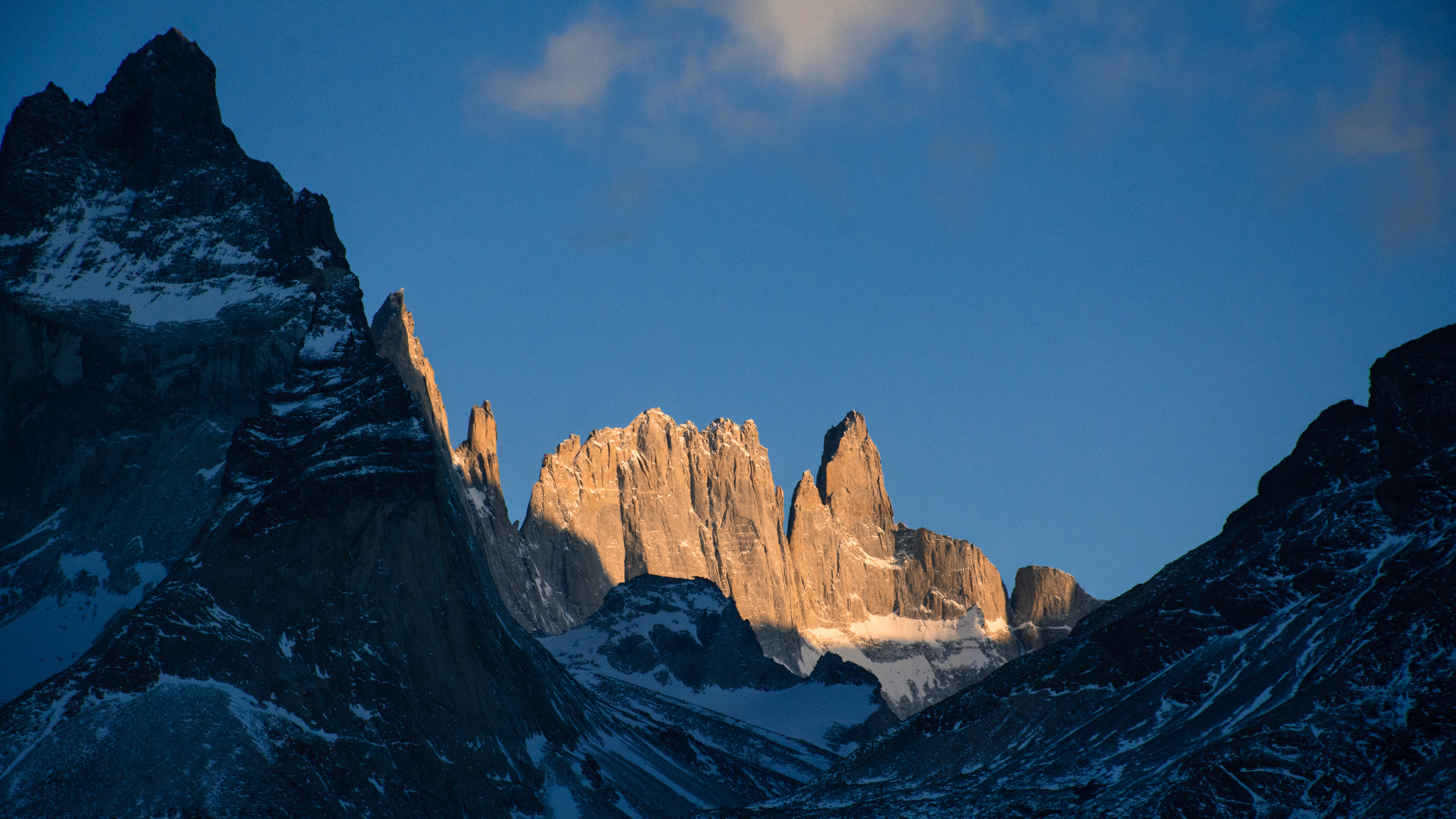
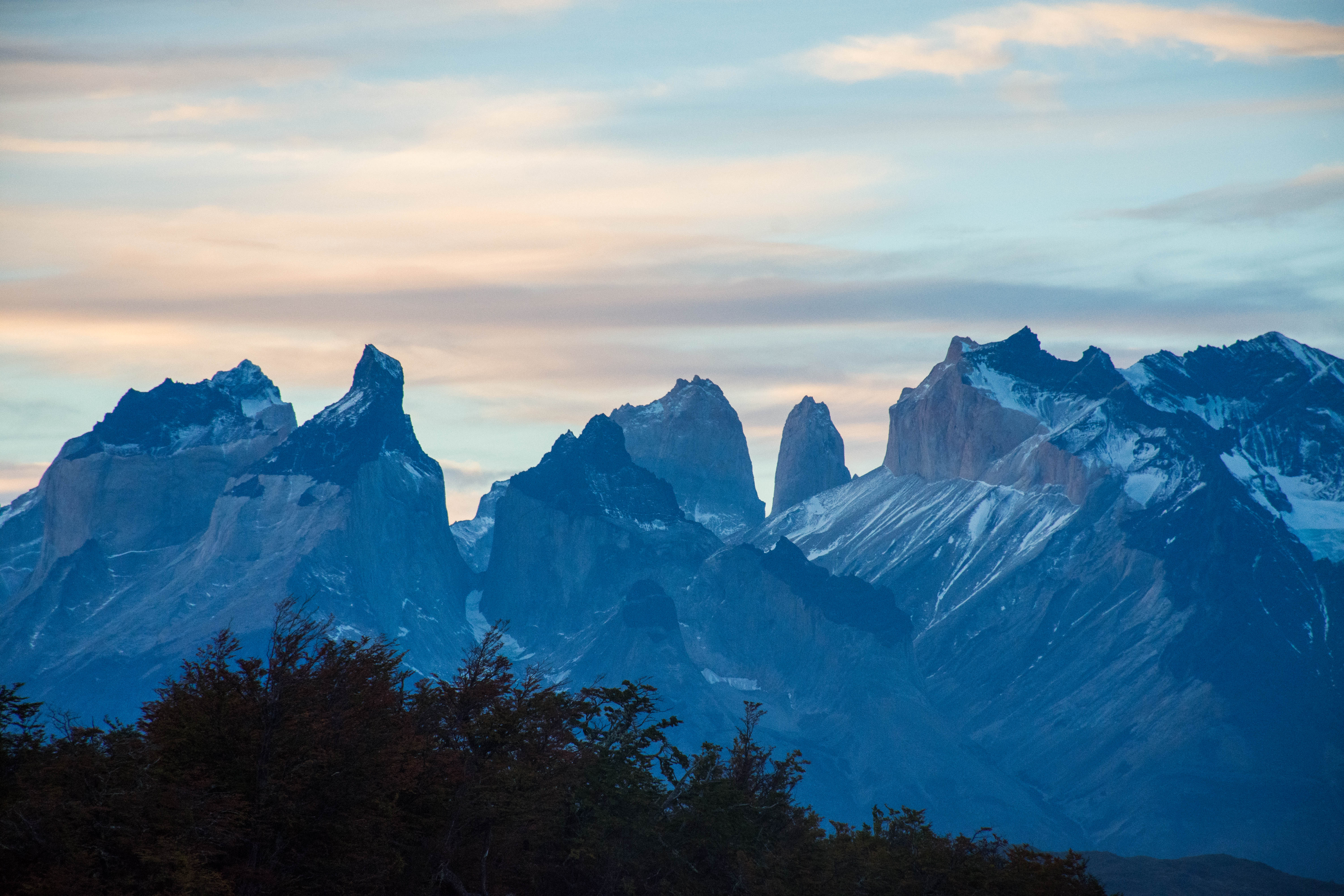
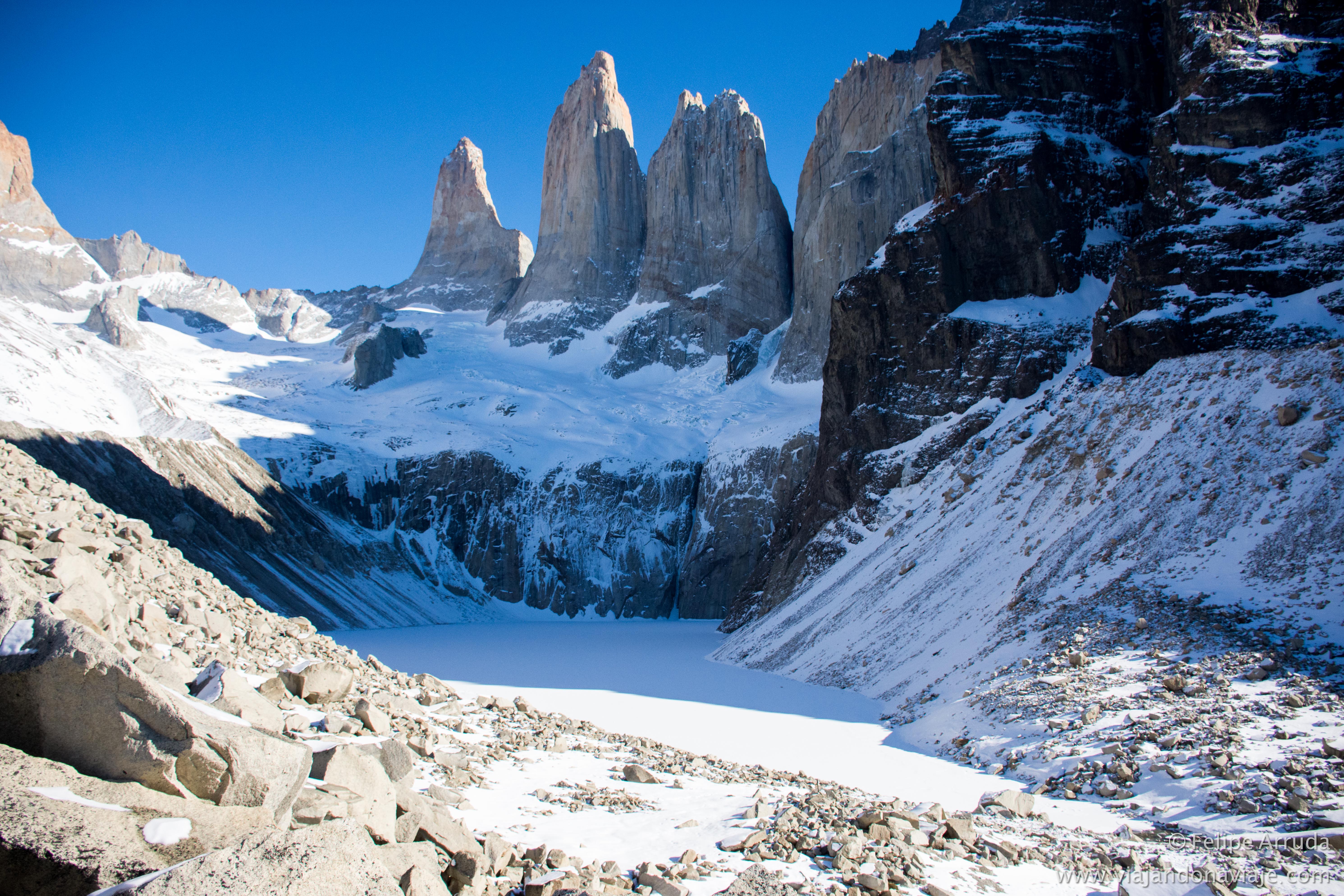
Torres del Paine (these are the most famous mountains in the park, made up of three peaks):
South tower: 2,500m; Central tower: 2,460m; North tower is 2,260m.
Fortress Hill: 3,000m.
Cathedral Hill: 2,220m.
Cerro Negro and Los Mezillos: 2,450m.
Shield Hill: 2,700m.
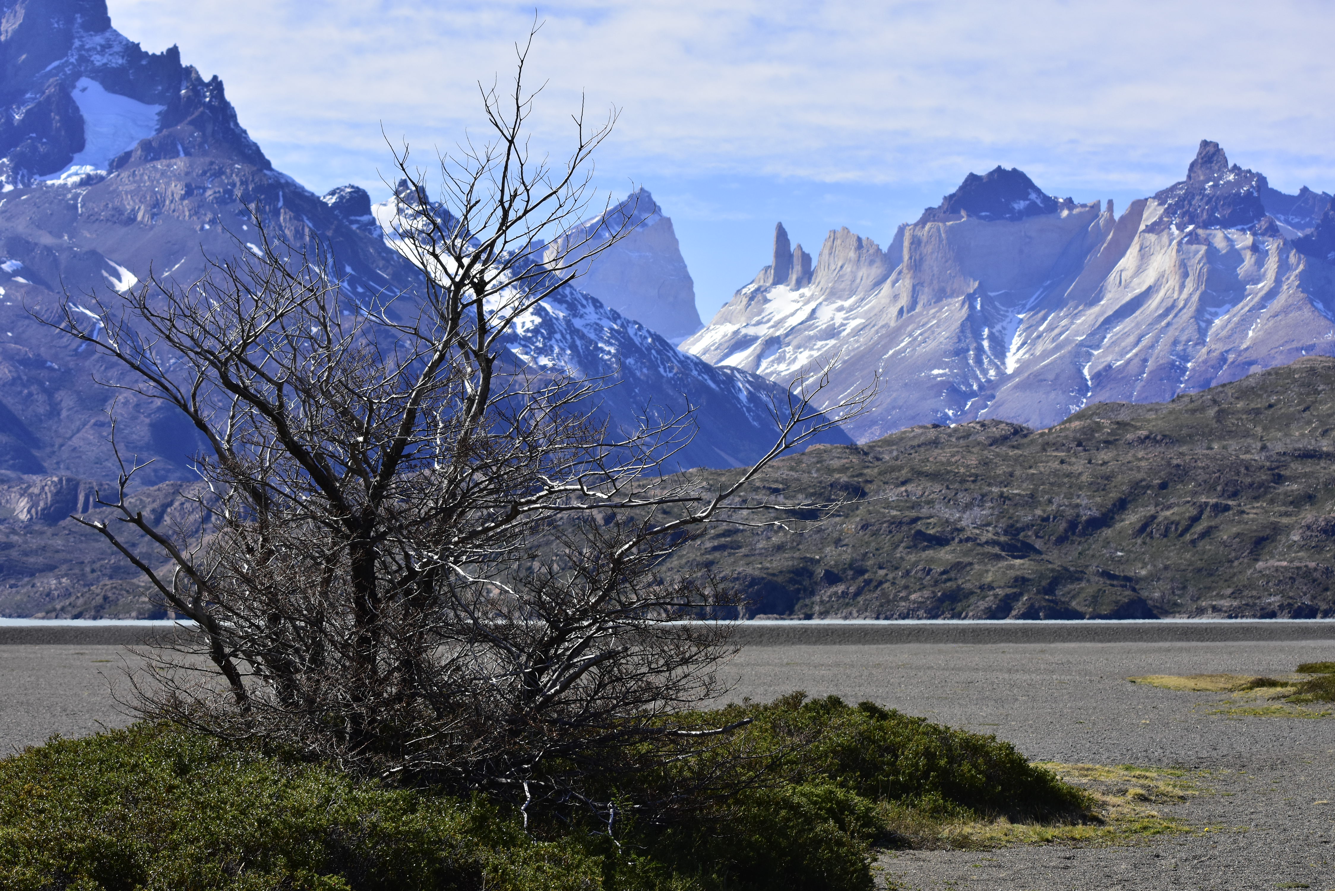
Cuernos del Paine (this is one of the viewpoints that can be seen from the famous French Valley hike):
Central Horn: 2,600m; North and West (both same altitud): 2,400m
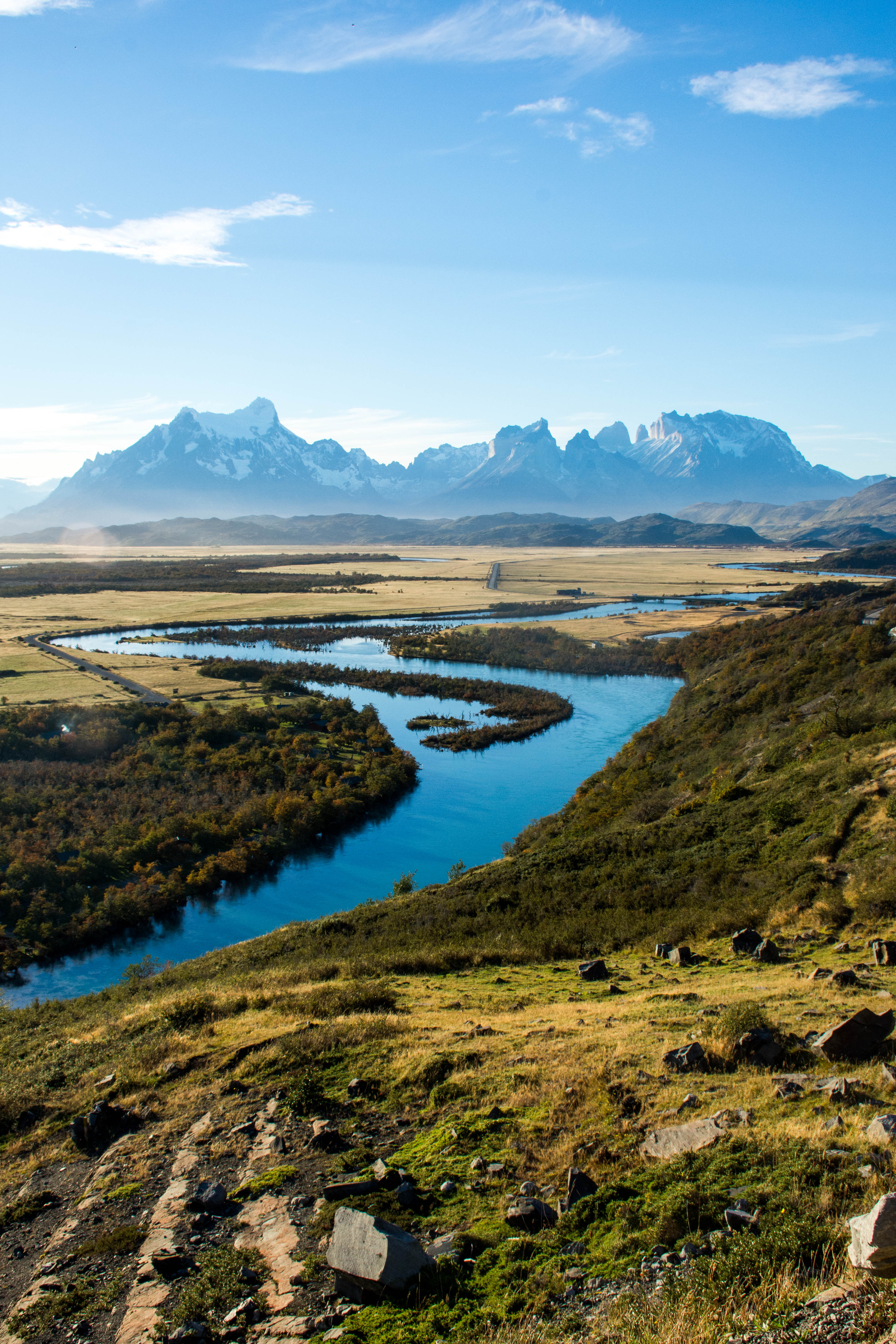
The park possesses a large drainage network, which consists of numerous rivers, streams, lakes, ponds, and cascades that come from the Southern Patagonia Ice Field and flow towards the southeast until the Última Esperanza Sound that bathes the coasts of the city of Puerto Natales.
The Southern Patagonian Ice Field takes up the entire western side of the park. The Southern Patagonian Ice Field feeds four main glaciers (from north to south: Dickson, Grey, Zapata, and Tyndall). This last glacier is rapidly receding. The largest is Glacier Grey.
Torres del Paine National Park Geology
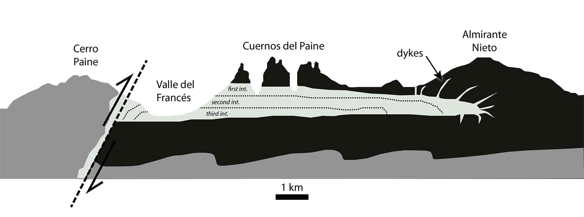
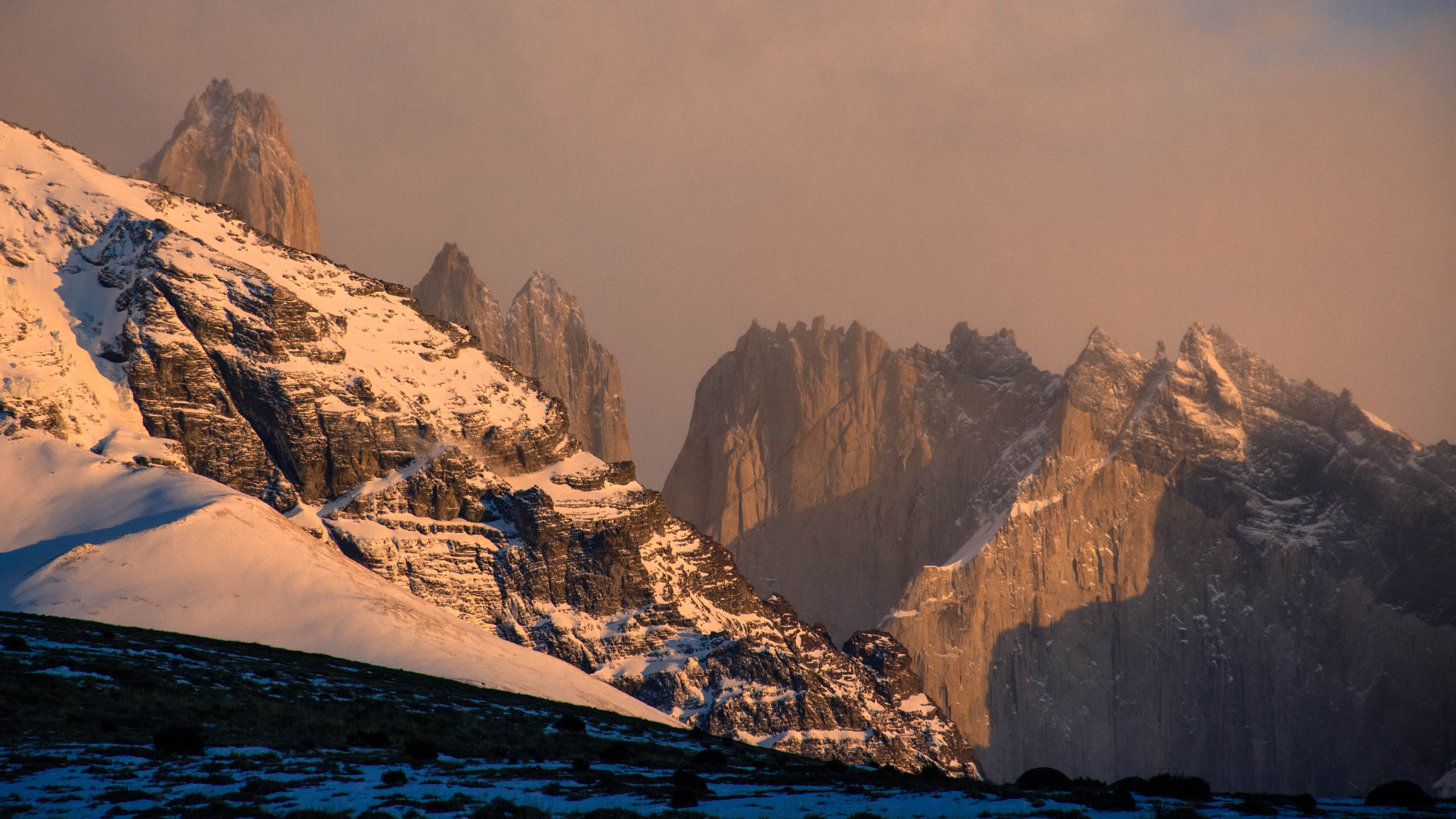
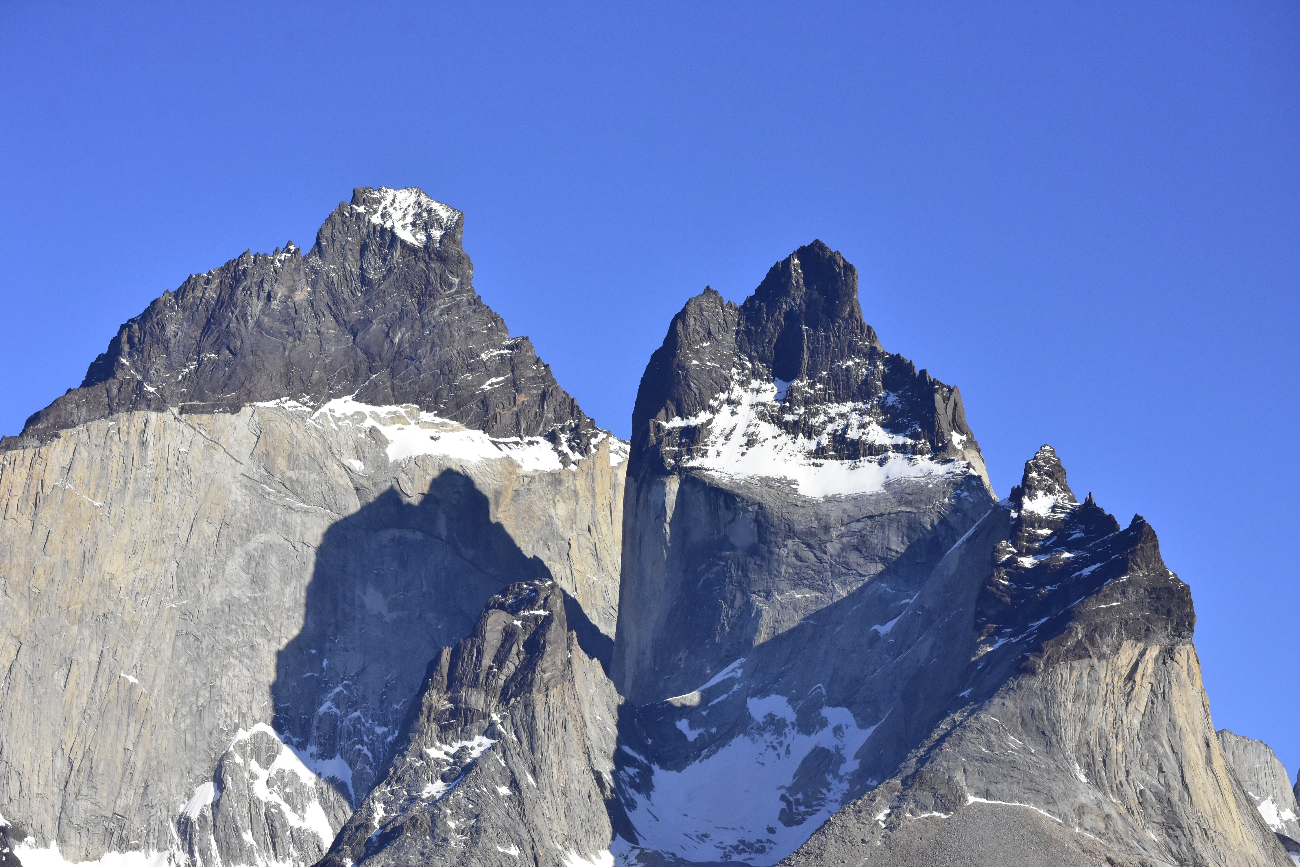
In addition to the peculiar shapes of the Torres del Paine, the gigantic granite towers 2.600m high approx., we can find Cuernos or «the Horns», with their contrasting colorations stand out, characterized by a prominent light-colored rock band, with flat and well-defined edges, which contrasts with the dark rocks that can be seen above and below them. The dark-colored rocks correspond to layers of sedimentary rocks that formed in an underwater environment, at the same time that the supercontinent of Gondwana was separating. For its part, the band of light rocks corresponds to igneous rocks, and are the result of the intrusion of at least four magmatic bodies of granitic composition. These granites were placed in sedimentary rocks while they were inside the Earth’s crust, about 13-12 million years ago, taking advantage of the zone of weakness generated by the Río Nutrias fault (Michael, 1984; Wilson, 1991), which at that time had fractured the (dark) sedimentary rocks.
Geologically speaking, the Miocene Torres del Paine Intrusive Complex (12.5 Ma) is formed by a subhorizontal granitic laccolithic that intruded on top of a mafic body. It extends for more than 12 km with a maximum thickness of 2.5 km. The laccolith is emplaced along a shallow to subhorizontal thrust fault, which is associated with internal folding and faulting developed during an early, pre-intrusion, thin-skinned tectonic phase that deformed the Cretaceous country rock (Halpern, 1973; Michael, 1991). Where the intrusion is thickest, it connects downwards with a subvertical feeder dyke emplaced along an old high-angle reverse fault, thought to be related with a period of thick-skinned tectonic shortening that caused a several kilometer uplift to the western block and consequent erosion of the stratigraphic cover. The granite intruded as a series of three sheets, each one underplating the previous sheet along the top of the basal Paine Mafic Complex. For more information, check «The Miocen Torres del Paine Intrusive Complex» link.
After millions of years buried in the depths of the Earth’s crust, due to the forces exerted by a series of tectonic uplift events, this entire set of rocks fractured, deformed and lifted (today above 2,000 m a.s.l.), leaving them exposed to erosion processes active on the surface, particularly affected by the Last Ice Age that began approximately 120,000 years ago and during the Upper Pleistocene, 12,000 to 17,000 years ago, these rocks (light igneous and dark sedimentary) were affected, differently depending on their hardness and resistance, by the erosive action of the glaciers. It is definitely a landscape of incomparable beauty unique in the world!
In respect of it being ‘a world class site for the study of structurally controlled emplacement and construction of shallow bimodal laccoliths’, the International Union of Geological Sciences (IUGS) included ‘The Miocene Torres del Paine intrusive complex’ in its assemblage of 100 ‘geological heritage sites’ around the world in a listing published in October 2022. The organization defines an IUGS Geological Heritage Site as ‘a key place with geological elements and/or processes of international scientific relevance, used as a reference, and/or with a substantial contribution to the development of geological sciences through history.
Most of this information was provided by the National Geology and Mining Service (CHILE) and proves the importance of this region from a geological point.
Here in southern Patagonia winter time is coming and it’s time to study and improve our knowledge. It’s also time to visit the Torres del Paine National Park without tourists or visitors, not working but as a curious apprentice, learning more to continue improving my knowledge as a local guide in one of the most beautiful regions in the world.


Gracias por la visita!
Thanks for your visit!
Felipe
http://www.viajandonaviaje.com
@felipeviajandonaviaje

Oi pipo
Sempre lembro de voce e sua equipe maravilhosa no Australis na nossa viagem de punta arenas a ushuaia….Em fevereiro estive pela terceira vez em ushuaia para partir para antartida: fabulosa viagem com a Quark Expedition por 20 dias Imagine que passagem de Drake suave!!
Fazia tempo que não recebia suas mails: deveria estar viajando,mas que cantos do universo foi desbravar?? Agradeço pela historia de Torres del Paine uma das minhas regiaoes preferidas junto com os Lencois Maranhenses- já conheceu?
Abraço
Micaela krumholz